Renewable Resource Management
Renewable resources (fish, wildlife, and forests) have sustained the people of the Mackenzie Basin for countless years. In the past, each part of the resource base was managed separately without consideration of how it might be related to the whole. This division often allowed conflicting resource policy to develop.
Resource management has changed over the years, but many people in the Sahtu still have an intimate relationship with the land. The communities use renewable resources in a holistic way – for food, healing medicines, spiritual sustenance, cultural and heritage activities, recreation and income.
In 2000, the Sahtu Land Use Planning Board undertook a Resource Mapping project. The project focused on interviewing people about their uses and knowledge of trapping, timber, fish and plants. People provided the most detailed information about fish harvesting, showing the importance of fish as a subsistence food.
The study showed that people use timber resources for a wide variety of purposes, including traditional arts, healing, construction and firewood. This is reflected in their specific knowledge of the variety of timber available, where drywood, rotten wood and driftwood are included as separate categories. Campsites for hunting, trapping or recreation would often be selected specifically because of the quality of the surrounding timber stand.
Berries and plants are also important resources for people. Berry picking is an important activity for women in the fall. Many people, especially elders, continue to use plants and trees for medicinal purposes.
From "Renewable Resource Potentials for Alternative Development in the Mackenzie River Region," by John T'Seleie and Robert Ruttan, in Dene Rights: Supporting Research and Documents, Vol. 5, Dene Development.
Fisheries are probably the most important renewable resource in the Northwest Territories in terms of quantity and potential for future economic development. Their value as a domestic resource of native people has been clearly documented.
In order that all of the future demands on the fisheries be met, the resource must be safeguarded from pollution and other environmental damage such as over-fishing and hazards such as large dams and other river uses which destroy or damage spawning areas or block migration between critical seasonal habitats.
Furbearing mammals have been the major source of income for native people from the beginning of the fur trade until recent years. Although socioeconomic changes have caused a 'decline in the fur industry,' many individuals still trap for profit and as a way of life.
Forest resource productivity in the north is low and timber growth is very slow; up to 200 years may be required to grow a merchantable tree. While existing sawmills are not all recognised as highly profitable ventures, they contribute substantially to the local economies by furnishing seasonal jobs and locally needed products.
Limited operation mills designed to serve the needs of small communities may well prove to be the most efficient way of utilising the irregularly distributed timber resources of the upper Mackenzie Basin. Careful planning and appropriate safeguards reduces or avoids deleterious impacts. Future management of northern forests also considers the value of forests as a critcal wildlife habitat and important in the protection of watersheds.
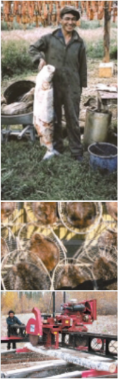
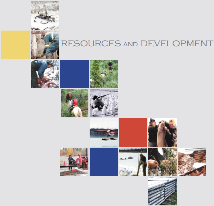
Pictures top to bottom
Drying fish
Stretching beaver skins, Fort Good Hope
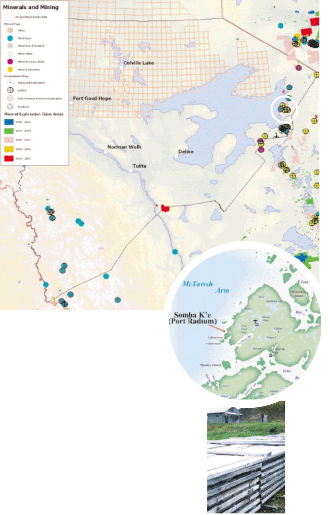
Fort Good Hope community sawmill
Sahtu Settlement Harvest Study
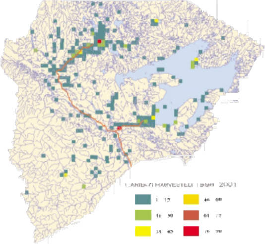
The Sahtu Settlement Harvest Study is an important project required under the Sahtu Dene and Métis Comprehensive Land Claim Agreement (13.5.6) and is the responsibility of the Sahtu Renewable Resources Board (SRRB).
The most recent Sahtu Settlement Harvest Study of Sahtu Dene and Métis hunters, trappers and fishers counted the number of animals, fish and birds currently harvested by Sahtu Dene and Métis throughout a five-year period (1998- 2003). The study is confidential; harvester names are not released and information collected not used to prosecute harvesters.
The communities of Colville Lake, Fort Good Hope, Norman Wells and Tulita began participating in the Harvest Study in April 1998. The community of Deline began participating in January 1999. Harvest data was collected on a monthly basis by a community field-worker using a census approach – the aim was to interview every eligible harvester in the Sahtu. An eligible harvester met all the following conditions:
- Is a Sahtu Dene, Métis or non-participant of the claim who provides for their Sahtu Dene-Métis family
- Currently resides in the Sahtu Settlement Area
- Is 16 years of age or over
- Currently hunts, fishes and/or traps
Data collected is entered in the Harvest Study Database. Once completed, the database will be used as a tool by the SRRB to do two main things:
- Make effective management decisions regarding the land and natural resources in the Sahtu
- Determine the Sahtu Basic Needs Level, which is the number of animals required to feed all Sahtu, Dene and Metis households each year so their harvesting traditions can be protected.
[ Sahtu Atlas Table of Contents ]
[ Next Section ]
Tourism
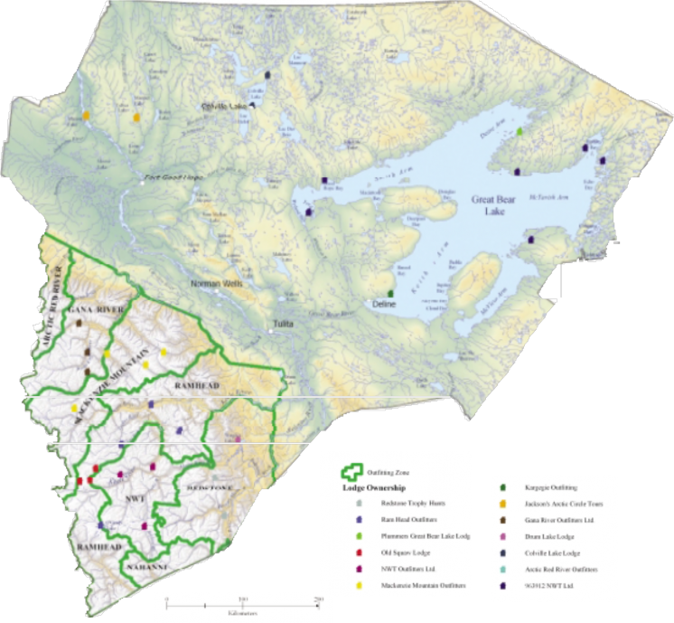
Outfitting zones and lodges
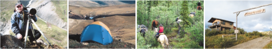
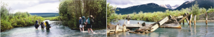
In summer, the Sahtu becomes a mecca for adventurers from other places. These people are seeking to experience the scenery and wildlife of one of the world's last great wildernesses. Increasingly, these people are having an impact on the economy of the Sahtu.
Overall, tourism has been expanding. Hunting and fishing has historically been the strongest sector in the tourism business. However, the popularity of canoeing, kayaking and hiking has been growing in recent years. Americans and Europeans in particular are attracted by the cheap dollar. As well, word has been spreading about the outstanding experience and services available in the Sahtu.
The logistics of transporting people into the area by air can be costly. But the number of tourists is proportionately smaller. This enhances the wilderness experience, and reduces the social and environmental impacts.
Tourism can have a stabilizing influence on the regional economy, being less subject to the fluctuations of the petroleum industry. Tourism tends to provide significant jobs over a long period of time. One dollar spent by a tourist in the region generates about $3 of business on average.
Spring Hunt A Family Tradition
By Teri Bavard, Aurora College, Tulita
The dictionary says that a tradition is a belief or custom which is handed down from generation to generation. In some families, it is a tradition to open presents after the midnight mass on Christmas Eve, or to eat turkey and have the family over on Thanksgiving.
My family has many customs and traditions. One that I especially like is the tradition of going out on the land for spring hunt.
In April, when it is early spring, our family and relatives get together and help each other to go to the campsite up the Mackenzie River before the ice melts. We use the skidoo to take the things in the bush. After breakup, we return to town by boat. It takes just one day to get there.
The tradition of spring hunt is carried on from our ancestors. At least that is what I believe. Following the old ways, many of the people of our community still go out on the land. Traditions are important because it is a way of keeping families together and being there for each other.
We like it out on the land. It is a lot of work, but we enjoy being out on the land with the fresh air. There are many things to do, such as setting snares or just going for a walk to see the beautiful scenery.
I really enjoy the bush, and it is good to know that my children are learning how to live on the land. I especially like the quietness and the peacefulness, and listening to the birds sing. It is a wonderful feeling to experience. You feel free out there on the land.
[ Sahtu Atlas Table of Contents ]
[ Next Section ]


 Phone: 867-374-4040
 Email: